Drone Analytics 2.0: How Aerial Vision Transforms Field Operations
Introduction — Why Drone Analytics Is Moving From “Nice-to-Have” to Board Agenda
Drones have rapidly evolved from a niche tool for aerial photography into a cornerstone of modern field operations. Today, they are redefining how enterprises collect, process, and act on visual data at scale. For C-level executives, this shift isn’t about technology for technology’s sake — it’s about measurable outcomes that impact the bottom line, risk profile, and strategic agility.
In sectors like energy, agriculture, logistics, construction, and infrastructure, drones are delivering high-resolution imagery and video faster, safer, and more frequently than manual inspections ever could. But it’s not just about the flying hardware. The true game-changer lies in what happens after the drone captures the data.
Enter drone analytics 2.0 — a new wave of smart aerial solutions powered by computer vision and AI. With edge computing and cloud-based APIs, companies can now automate the detection of defects, monitor asset conditions, track inventory, and flag anomalies with unprecedented speed and precision. Instead of waiting days or weeks for human review, decision-makers can get insights within hours, sometimes even in real time.
This transformation is particularly critical as operations scale and compliance demands intensify. Executives are under pressure to increase productivity while reducing operational risk, downtime, and emissions. Drone analytics delivers on all fronts:
Cost efficiency by automating repetitive visual inspections and reducing the need for on-site personnel or equipment rentals.
Risk reduction by eliminating hazardous tasks like climbing towers or navigating confined spaces.
Regulatory agility by providing consistent, auditable visual documentation for compliance reporting.
Sustainability gains by cutting fuel usage and emissions tied to traditional inspection methods.
Moreover, advances in cloud-native vision APIs — such as object detection, logo recognition, background removal, and image anonymization — have dramatically lowered the barrier to entry. Companies no longer need to build full-fledged AI systems in-house. They can integrate ready-made APIs into their drone data pipelines and scale quickly, while also retaining the flexibility to develop custom AI solutions when needed.
In short, drone analytics is no longer a side experiment delegated to innovation teams. It’s becoming a core pillar of digital transformation strategies — impacting operational KPIs, ESG metrics, and competitive positioning. For forward-looking leadership, the question is no longer if drones should be part of your operations — it’s how fast you can deploy them to gain an edge.

Market Drivers & Risk Landscape — Cost, Compliance, and Carbon
Drone adoption across field-intensive industries is accelerating — not just because of innovation, but because of mounting pressure on operational efficiency, regulatory compliance, and sustainability performance. For C-level leaders, these forces are not abstract trends — they are direct levers impacting EBITDA, reputation, and investor confidence.
Rising Costs of Manual Operations
Traditional field inspections rely heavily on skilled labor, specialized vehicles, and time-consuming scheduling. Whether it's inspecting pipelines, monitoring construction progress, surveying crops, or auditing large logistics yards, the manual approach is expensive and slow. Labor shortages, increasing insurance premiums, and inflationary pressures on logistics further compound the issue.
Drones, paired with AI-powered analytics, address this challenge head-on. A single drone flight can inspect dozens of assets in minutes, reducing both the cost-per-inspection and the need for repeated site visits. More importantly, drones reduce downtime by enabling earlier detection of issues — helping executives avoid the high cost of reactive maintenance and unplanned outages.
Regulatory Pressure and Compliance Cycles
Governments and industry regulators are tightening standards across sectors. From energy and utilities to telecom and infrastructure, inspection cycles are becoming more frequent and more detailed. In Europe, digital inspection records are increasingly required for environmental and safety audits. In the U.S., the FAA is advancing its support for Beyond Visual Line of Sight (BVLOS) operations, effectively expanding the operational envelope for drones.
These shifts make automated visual documentation a strategic necessity. Drones provide consistent, high-fidelity imagery that can be automatically analyzed, timestamped, and archived — reducing compliance risk while enabling more transparent, auditable operations. Vision-based APIs such as image labelling and object detection enhance this process by translating visual data into structured reports suitable for regulatory submission.
Carbon Reduction and ESG Performance
Sustainability is no longer just a CSR talking point — it’s a board-level imperative. Companies are under pressure to reduce their Scope 1 and Scope 2 emissions, and investors increasingly factor ESG metrics into valuation. Traditional inspection methods often involve fuel-intensive equipment like helicopters, ATVs, or diesel trucks. Drones offer a cleaner alternative with far lower carbon footprints.
When combined with cloud-based processing and optimized AI pipelines, drone analytics contributes to a leaner environmental profile. For instance, API-based background removal or face anonymization reduces storage and compliance overhead by processing only relevant parts of imagery — minimizing the data footprint and aligning with data governance standards.
Strategic Takeaway
The convergence of cost pressure, compliance demands, and climate accountability is creating a “perfect storm” of urgency for drone analytics. For executives, the message is clear: adopting aerial vision isn’t just about embracing innovation — it’s about protecting margins, satisfying regulators, and proving ESG commitment to stakeholders. Organizations that act now position themselves to lead in operational excellence, while those that delay risk falling behind on both financial and reputational fronts.
Tech Stack Deep-Dive — From Aerial Capture to Executive Dashboard
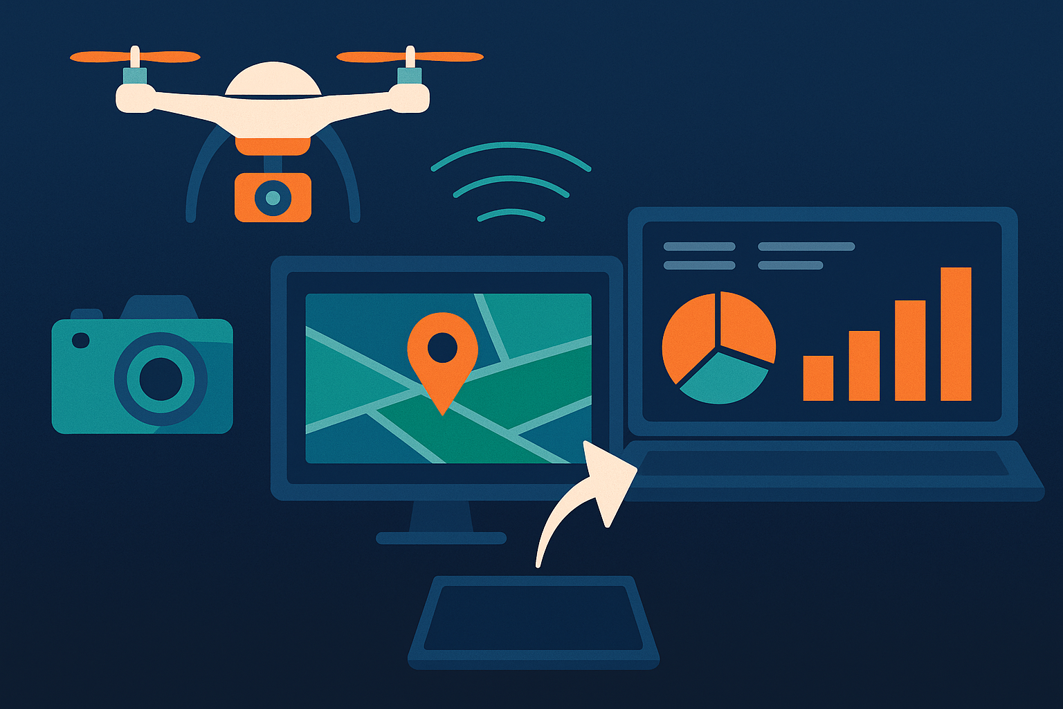
For drone analytics to deliver real business value, the technology must do more than capture images — it must transform raw aerial data into timely, actionable insights that drive decision-making. That transformation relies on a robust yet flexible tech stack, which has matured significantly in recent years. Today’s leading systems combine drones, edge AI, cloud-based APIs, and analytics platforms in an orchestrated pipeline that is both scalable and cost-efficient.
Intelligent Capture at the Edge
The journey begins in the air. Modern drones equipped with edge AI chips can perform real-time inference directly on the device. This means they can detect objects, flag anomalies, or segment regions of interest while still in flight — without needing to transmit full video streams back to a server. This edge-first approach dramatically reduces bandwidth costs, minimizes latency, and allows for instant feedback loops. For instance, a drone surveying a utility line can detect corrosion or vegetation encroachment in real time and alert the operator before leaving the site.
Seamless Upload and Cloud Processing
After flight completion, captured imagery and metadata are automatically uploaded to cloud storage via 5G or satellite links such as Starlink. This triggers an automated workflow where the real intelligence happens — using a stack of cloud-based vision APIs to process and analyze the data.
These APIs act as building blocks that convert imagery into structured information. Object detection APIs can identify and count specific assets, OCR APIs can read serial numbers or warning signs, brand mark recognition APIs can verify logos and labels, while image anonymization APIs ensure compliance with privacy regulations by blurring faces or license plates. These capabilities can be chained together into processing pipelines tailored to the business context — whether it’s auditing inventory in a shipping yard or inspecting rooftop installations in a solar farm.
For more specialized use cases, such as identifying rare asset types or subtle manufacturing defects, companies can integrate custom-trained AI models into the pipeline. This hybrid approach allows businesses to start fast with off-the-shelf APIs and scale up to bespoke solutions as needs evolve.
Unified View for Decision-Makers
The final step is where data becomes insight: dashboards. Processed outputs are aggregated into cloud-based visual analytics platforms or business intelligence tools that executives already use. Interactive maps, heatmaps, time series charts, and anomaly reports make it easy for leaders to track asset conditions, flag urgent issues, and validate work completion without ever visiting the site.
These dashboards can also integrate with enterprise systems such as ERP, EAM, or CMMS, enabling seamless alignment between drone intelligence and operational workflows. For example, a flagged defect on a transmission tower can automatically generate a work order and be assigned to a technician within minutes.
Security and Governance by Design
For C-level executives, security, data privacy, and compliance are non-negotiable. The modern drone analytics stack supports role-based access, encrypted data transfer, and automated redaction of sensitive content. Vision APIs such as face detection and anonymization ensure that all captured media complies with GDPR and other local privacy regulations — critical when operating in public or mixed-use environments.
Strategic Takeaway
The sophistication of today’s drone analytics tech stack lies in its modularity and readiness for enterprise integration. With edge intelligence, scalable APIs, and seamless data-to-dashboard workflows, executives can expect not just better visibility — but faster, safer, and smarter operations. Importantly, the infrastructure is flexible enough to evolve with the business, enabling a phased, low-risk path from pilot to production at scale.
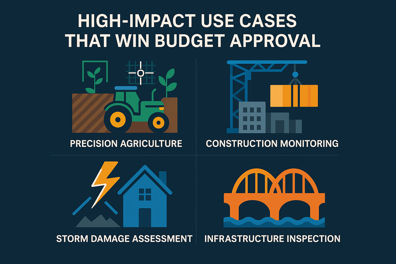
High-Impact Use Cases That Win Budget Approval
While drone analytics may seem futuristic to some, its real-world impact is already being felt across industries. What sets successful projects apart is their ability to deliver quantifiable improvements to mission-critical operations — exactly the kind of outcomes that justify investment at the executive level. From energy grids to logistics hubs, C-level leaders are funding drone initiatives not for novelty, but because the ROI speaks for itself.
Energy & Utilities: From Reactive Maintenance to Predictive Uptime
In power generation, transmission, and distribution, the ability to detect early signs of wear, corrosion, or vegetation overgrowth can prevent catastrophic failures. Traditionally, these inspections require ground crews, helicopters, or even shutdowns. Drones eliminate much of this overhead by enabling remote, frequent, and non-invasive surveys.
When paired with object detection and image labelling APIs, drones can automatically flag anomalies such as rusted joints, heat spots, or structural damage. These findings are not just visual — they're actionable, enabling maintenance teams to prioritize repairs based on risk and severity. The result: fewer outages, lower repair costs, and improved compliance with inspection mandates.
Agriculture: Precision at Scale
In large-scale farming operations, drones have become an essential tool for crop monitoring, irrigation planning, and yield forecasting. High-resolution aerial imagery can be processed with custom-trained computer vision models to detect plant stress, pest infestations, or nutrient deficiencies — far earlier than visible to the human eye.
Optical character recognition (OCR) APIs further support agribusiness by reading plot markers, equipment labels, or packaging codes captured in drone footage, automating record-keeping and traceability. For C-level leaders aiming to boost productivity while reducing input costs, drone analytics supports smarter spraying decisions, optimized harvest timing, and a measurable increase in yields.
Logistics, Ports & Warehousing: The Visibility Gap Closes
Drone analytics transforms how enterprises manage outdoor storage yards, port terminals, and large logistics campuses. Manual inventory audits are labor-intensive and error-prone — leading to misplaced assets, underutilized space, and slow turnaround times.
With aerial imagery analyzed by OCR and brand recognition APIs, drones can autonomously identify container numbers, barcodes, or company logos — offering near real-time visibility into asset location and volume. This enables better planning, faster throughput, and improved customer satisfaction. Executives benefit from reduced dwell time, minimized demurrage costs, and stronger SLAs.
Construction & Infrastructure: Progress Verified, Safety Assured
Construction sites are dynamic, high-risk environments where both progress and safety must be monitored closely. Drones equipped with computer vision help track project milestones, compare actual builds against BIM models, and detect structural changes or unauthorized work.
At the same time, face detection and PPE-compliance recognition can automate safety audits — ensuring that workers are wearing helmets, vests, and harnesses. For project owners and contractors, this translates to fewer delays, minimized liability exposure, and stronger proof-of-performance for clients and regulators.
Strategic Takeaway
Each of these use cases represents not just operational optimization, but a clear business case with board-level implications. The key is focusing on pain points that matter — downtime, compliance, accuracy, and safety — and showing how drone analytics delivers measurable improvement. By aligning drone initiatives with executive priorities, organizations can move quickly from pilot projects to full-scale deployment with leadership support and clear KPIs.

C-Suite KPI & ROI Framework — Quantifying the Upside
For any emerging technology to gain executive buy-in, it must pass the most critical test: measurable impact on performance and profitability. Drone analytics clears this hurdle by offering a new layer of visibility and automation that directly translates into operational KPIs and financial gains. For C-level executives, the ability to connect drone initiatives to hard business metrics — rather than abstract potential — is what unlocks budget, accelerates adoption, and scales success.
Inspection Cost per Asset
One of the most immediate benefits is a sharp reduction in the cost of visual inspections. By replacing manned flights, scaffold setups, and multi-day ground crew operations with short autonomous drone missions, companies are seeing inspection costs per asset drop by 30–70%. This is especially impactful in industries with geographically dispersed assets like pipelines, transmission lines, or rail networks. Drones reduce both the frequency and cost of failures by enabling more frequent, proactive monitoring.
Mean Time to Detect and Resolve Issues
Drone analytics dramatically shortens the time it takes to spot and respond to anomalies. Traditional inspection cycles often take days or weeks to complete, and even longer to analyze. With vision APIs performing real-time or near-real-time detection, businesses can identify issues such as equipment failure, crop stress, or safety violations within hours — sometimes minutes — of occurrence. This reduction in Mean Time to Detect (MTTD) and Mean Time to Repair (MTTR) minimizes operational downtime and limits damage escalation.
Downtime Avoidance and Revenue Protection
Unplanned downtime is one of the most expensive line items in any operational budget. Whether it's an idle wind turbine, a grounded aircraft, or a halted production line, every minute offline has a measurable revenue impact. Drone analytics offers early warning systems that help preempt failures before they disrupt operations. By correlating faster detection with historical outage costs, executives can model the financial value of avoided downtime — and justify investment in drone-based monitoring systems accordingly.
ESG Metrics and Emission Reductions
Sustainability targets are now tied directly to executive compensation, shareholder trust, and regulatory compliance. Drone operations offer a greener alternative to traditional methods like helicopter surveillance or vehicle-based inspections, both of which contribute heavily to Scope 1 emissions. Moreover, cloud-native AI processing minimizes energy waste by focusing only on relevant insights rather than storing and reviewing massive volumes of raw video. C-level teams can report tangible emissions reductions per mission and show alignment with ESG and carbon disclosure goals.
Data-to-Decision Velocity
Executives are increasingly focused on the speed at which insights lead to action. Drone analytics enables an accelerated “data-to-decision” cycle. What once took weeks — from field capture to analysis to reporting — can now be compressed into a single day or even hours. This speed enables more agile responses to risk, more confident executive reviews, and better-informed strategic planning. It also positions businesses to respond faster than competitors when opportunities or threats arise.
Strategic Takeaway
Drone analytics is not a future-facing investment — it’s a current lever for value creation. By tracking the right KPIs, organizations can build compelling business cases that resonate in the boardroom. From reducing costs and emissions to protecting revenue and accelerating decisions, drone-powered insights translate directly into outcomes executives care about. The technology is ready — not just to monitor operations, but to optimize them in ways that move the top and bottom lines.

Implementation Playbooks — Build, Buy, or Blend
The decision to operationalize drone analytics at scale isn’t just about the technology — it’s about choosing the right path to value. For C-level leaders, the key is to balance speed, customization, and long-term sustainability. Whether you opt for off-the-shelf components, invest in custom-built AI models, or blend both approaches, your implementation strategy must align with your business priorities, regulatory landscape, and resource constraints.
Off-the-Shelf APIs for Immediate Impact
The fastest path to value is through existing cloud-based vision APIs. These ready-made tools can process drone imagery right out of the box — performing tasks like object detection, face and license plate anonymization, logo recognition, background removal, and OCR. They integrate easily with most drone data pipelines and require minimal development effort, making them ideal for teams looking to launch pilots or address common pain points quickly.
For example, a logistics company can use OCR APIs to automate container ID recognition from aerial footage. A construction firm can apply object detection to monitor heavy equipment movement and track progress by comparing drone imagery against planned layouts. These plug-and-play capabilities allow companies to start small, iterate rapidly, and prove ROI without committing to large upfront investments.
Custom AI for Strategic Differentiation
However, when use cases involve specialized assets, complex environments, or mission-critical accuracy thresholds, off-the-shelf tools may fall short. This is where custom AI models become a strategic asset.
Tailored computer vision solutions can be trained to recognize highly specific defects, equipment types, terrain conditions, or brand assets unique to your business. For instance, a utility provider may need to detect micro-cracks on wind turbine blades, or an agriculture firm might require disease-specific plant classification for its crop varieties.
While custom development requires more investment upfront, it delivers long-term operational and competitive advantages. These solutions are often more robust, accurate, and aligned with real-world conditions. When executed thoughtfully, they frequently reach cost breakeven within 12 to 18 months — especially when scaled across multiple sites or business units.
Blended Approach for Scalability and Flexibility
In many cases, the most effective strategy is a blended one: start with standardized APIs to solve generic problems and expand with custom AI where deeper insights or differentiation are needed. This hybrid model allows for rapid deployment without sacrificing the ability to tailor systems over time.
A phased rollout can begin with a limited geographic or operational scope — using off-the-shelf APIs to validate the process and quantify the upside. As confidence grows, you can layer in custom models, tighter system integration, and higher levels of automation. This approach minimizes risk, maximizes learning, and keeps the project aligned with evolving business needs.
Integration with Enterprise Systems
To unlock full value, drone analytics must connect seamlessly with the broader enterprise IT stack. This includes integrating processed outputs into existing ERP, EAM, or CMMS platforms, automating ticket creation, alert generation, and compliance reporting.
Modern vision APIs and AI platforms support RESTful interfaces, webhook triggers, and secure cloud environments — making integration with your existing data infrastructure straightforward. With the right governance in place, these systems can be scaled securely across teams, regions, and business units.
Managing Change and Securing Buy-In
As with any digital transformation, technology alone is not enough. Success hinges on people, processes, and alignment. Start by identifying one or two high-impact use cases where drone analytics can deliver immediate wins. Appoint a senior executive sponsor to champion the initiative, secure funding, and drive cross-functional collaboration.
Pilot programs should be structured with clear KPIs, feedback loops, and a timeline for decision-making. Early success stories can then be used to build internal momentum and justify further investment.
Strategic Takeaway
Drone analytics implementation is not a binary decision — it’s a journey. C-level leaders should focus on outcomes, not tools. The most successful companies move quickly where they can, invest strategically where it matters, and build scalable systems that grow with the business. Whether you buy, build, or blend, the goal remains the same: to turn aerial data into enterprise-grade insights that drive smarter, faster, and more profitable decisions.

Conclusion — Turning Sky-High Visibility into Competitive Advantage
Drone analytics has evolved from a promising experiment into a powerful operational tool with real impact on efficiency, risk management, compliance, and sustainability. For C-level executives, the implications are clear: this is not just a technical upgrade — it’s a strategic enabler that drives better performance across the board.
The industries embracing drone-based visual intelligence are already seeing measurable returns. Faster inspections, early anomaly detection, reduced downtime, and lower emissions are not hypothetical outcomes — they are being realized today through well-structured drone analytics programs. The value multiplies when these insights are integrated into core business workflows, from maintenance planning to ESG reporting.
Equally important is the shift in accessibility. Executives no longer need to authorize large-scale infrastructure overhauls to leverage AI-powered drone analytics. Thanks to cloud-native vision APIs — like object detection, OCR, background removal, anonymization, and brand recognition — organizations can start with simple, scalable pilots. These tools require minimal upfront investment and offer immediate functionality, whether it’s reading container labels in a port or detecting equipment defects in a substation.
For organizations with more complex needs or domain-specific challenges, custom computer vision development unlocks deeper, more tailored value. With the right partner, these solutions can be aligned precisely to your operations, delivering accuracy and insights that outpace competitors and reduce long-term operational costs. It’s not just about collecting better data — it’s about making better decisions, faster.
Looking ahead, the role of drone analytics will only grow. Regulatory environments are becoming more demanding. Customers and investors are demanding greater transparency and environmental responsibility. Labor shortages continue to affect field operations. In this context, aerial intelligence is becoming a cornerstone of resilient, modern enterprises.
The path forward is pragmatic. Start with a focused use case. Identify clear KPIs. Leverage proven APIs where they apply. Build custom where it counts. Integrate with your existing systems. And most importantly — ensure there is executive ownership and a strategic mandate behind the initiative.
In the new landscape of field operations, the organizations that win won’t be those with the most drones. They will be those who extract the most value from each flight — turning every pixel into insight, every insight into action, and every action into competitive advantage. The sky is no longer the limit — it’s the starting point.