Image Processing & Drone Imagery: Multi-Industry Insights
Introduction: The Growing Impact of Drone Imagery
Over the past decade, drone imagery has transformed from a niche technology used primarily for aerial photography into a powerful tool for industries ranging from agriculture to security. Thanks to rapid advancements in camera technology and computer vision, drones can now capture high-resolution images and videos, making them invaluable for large-scale monitoring, inspections, and data collection. However, simply collecting visual data is not enough—image processing is what turns raw imagery into meaningful insights.
With the rise of AI-powered analysis, businesses and organizations can now leverage drones for more than just capturing stunning visuals. Artificial intelligence enables the automated identification of objects, detection of anomalies, and extraction of valuable information from drone footage. This synergy between drones and AI is driving efficiency, improving decision-making, and unlocking new possibilities across multiple industries.
The Evolution of Drone Imagery: More Than Just Aerial Photography
A decade ago, drones were primarily seen as tools for hobbyists and filmmakers. Today, they have become critical assets in industries that require real-time visual data. This shift has been driven by several key advancements:
Higher-Resolution Cameras – Modern drones are equipped with ultra-HD cameras capable of capturing detailed aerial views, allowing for precise analysis of landscapes, structures, and objects.
Enhanced Sensors – Beyond standard cameras, many drones now come with infrared, LiDAR, and multispectral sensors, making them useful for everything from crop health monitoring to thermal inspections.
Improved Flight Stability & Autonomy – Drones are now equipped with AI-driven stabilization, automated flight paths, and obstacle avoidance, ensuring more reliable data collection even in challenging environments.
Increased Accessibility – What was once an expensive, specialized technology has become more accessible, with drones now being widely adopted across industries like agriculture, construction, insurance, and security.
These improvements mean that businesses are generating more aerial imagery than ever before. However, raw drone footage alone is not enough—this is where advanced image processing plays a crucial role.
Why Image Processing is Essential for Drone-Captured Data
While drones can capture vast amounts of visual data, this data is often unstructured and overwhelming. Without intelligent processing, reviewing hundreds or thousands of drone images manually would be inefficient and prone to human error. AI-powered analysis helps bridge this gap by automating data extraction, classification, and decision-making.
Here’s why image processing is essential for unlocking the full potential of drone imagery:
1. Turning Raw Data into Actionable Insights
A drone capturing images of a construction site or a farm doesn’t inherently provide useful insights. However, with the right computer vision techniques, this imagery can be analyzed to detect progress, identify structural issues, or measure crop health. AI-powered tools help in:
Detecting anomalies, such as cracks in buildings or pest infestations in crops.
Automatically classifying and labeling objects, such as vehicles, equipment, or livestock.
Extracting text from aerial signs using OCR (Optical Character Recognition) technology.
2. Enhancing Accuracy and Speed
Traditional analysis of drone imagery requires human experts to review and interpret each frame manually. This is not only time-consuming but also prone to human bias. AI-powered analysis processes images instantly, identifying patterns and anomalies with high accuracy and consistency.
For example:
In disaster management, AI can quickly assess damage levels from aerial footage and generate reports for emergency response teams.
In logistics, AI-powered object detection can track vehicle movements in real time, improving supply chain efficiency.
3. Reducing Operational Costs
Manual review of drone imagery requires a team of specialists, which increases costs. AI-driven image processing reduces the need for human intervention, automating repetitive tasks and significantly lowering operational expenses. Instead of spending hours analyzing footage, businesses can rely on AI to detect, tag, and categorize important elements within seconds.
The Power of AI-Powered Image Processing for Drone Applications
As drones become more sophisticated, so do the AI models that process their imagery. Machine learning algorithms can now:
Recognize objects with remarkable precision, from identifying specific crops in agriculture to spotting defects in industrial equipment.
Remove unnecessary backgrounds from aerial images to isolate key details for clearer analysis.
Anonymize sensitive data by blurring out faces, license plates, or other personal identifiers in drone-captured footage.
Extract brand-related information from retail or advertising studies conducted via drone-based surveys.
By integrating computer vision into drone workflows, industries can automate decision-making, improve accuracy, and enhance efficiency in ways that were previously impossible.
The combination of drone imagery and AI-powered analysis is revolutionizing multiple industries. As drones continue to evolve, the ability to process their imagery efficiently will be the key to unlocking their full potential. Whether it’s for agriculture, security, or industrial inspections, computer vision and image processing technologies are transforming the way businesses leverage aerial data. In the next sections, we’ll explore how different industries are using drones, the challenges they face, and the latest advancements in AI-driven drone analytics.

AI and Drone Imagery: The Perfect Duo
Drones have revolutionized data collection by making aerial imagery more accessible, affordable, and detailed. However, raw drone footage by itself holds limited value unless it is effectively processed and analyzed. This is where artificial intelligence (AI) comes in. By leveraging AI-driven image processing, businesses and organizations can turn aerial data into actionable insights, automate decision-making, and significantly enhance operational efficiency.
AI plays a crucial role in transforming drone imagery, allowing for precise object detection, image classification, and text extraction from aerial views. Whether used for monitoring infrastructure, analyzing agricultural fields, or enhancing security operations, AI-powered analysis ensures that vast amounts of drone-captured data are processed quickly and accurately.
How AI Transforms Visual Data
Artificial intelligence, particularly machine learning, enables drones to go beyond simple image capture and actively interpret and analyze what they see. Machine learning models trained on vast datasets allow drones to recognize patterns, detect anomalies, and categorize objects with a level of accuracy that far surpasses human analysis.
Here’s how AI enhances drone imagery processing:
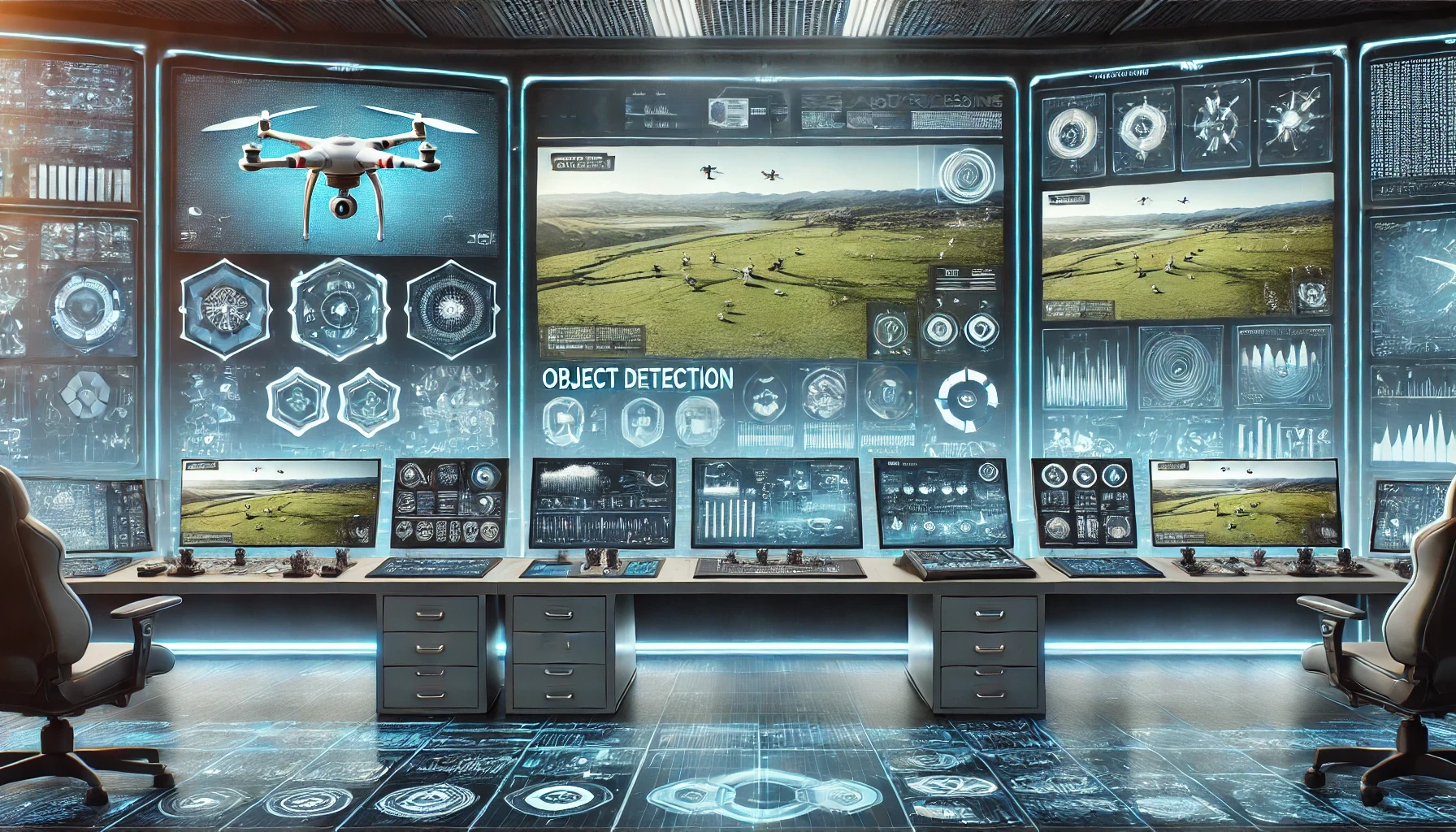
1. Object Detection and Classification
AI-powered object detection allows drones to identify and label specific objects within an image. For example:
In agriculture, AI can differentiate between healthy and diseased crops, enabling farmers to take timely action.
In construction, drones can identify vehicles, equipment, and structural components, helping track progress and detect safety hazards.
In wildlife conservation, AI can count animals in drone footage and analyze their movement patterns to assess ecosystem health.
By automatically tagging and categorizing objects, AI saves time and ensures accuracy in large-scale monitoring projects.
2. Image Classification and Segmentation
AI-based classification systems can categorize drone-captured images based on their content. This is particularly useful for:
Land surveying, where AI helps classify different land types (forests, water bodies, urban areas) from drone maps.
Disaster response, where AI can distinguish between damaged and undamaged buildings after a natural calamity, aiding in relief efforts.
Segmentation further refines this process by breaking images into different regions, making it easier to analyze specific areas in detail.
3. Optical Character Recognition (OCR) for Text Extraction
Drones frequently capture text-based information from signs, labels, and infrastructure markings. AI-powered OCR (Optical Character Recognition) can automatically extract and convert this text into machine-readable format. This capability is valuable in:
Supply chain and logistics, where drones scan shipping container labels and vehicle license plates.
Urban planning, where AI reads street signs and building numbers to update mapping databases.
Surveying and inspections, where regulatory markings on buildings, towers, or roads need to be digitally documented.
OCR allows for automated data extraction, reducing the need for manual review and improving operational efficiency.
Key Benefits of AI-Driven Data Analysis
Using AI to process drone imagery offers multiple advantages. It enhances speed, accuracy, scalability, and cost-effectiveness, making it a game-changer for industries relying on aerial data.
1. Improved Accuracy and Speed
One of AI’s biggest advantages is its ability to process and analyze thousands of images in seconds. Unlike manual analysis, which is prone to errors and inconsistency, AI-driven models ensure high precision in detecting objects, measuring distances, and classifying images.
For instance:
In infrastructure inspections, AI can highlight structural cracks or corrosion in bridges and buildings with pinpoint accuracy.
In forestry management, AI can scan thousands of aerial images to track deforestation trends or identify illegal logging activities.
In security and surveillance, AI can automatically flag suspicious activity in real time, reducing response time for security personnel.
This speed and precision allow industries to make informed decisions faster, leading to improved efficiency.
2. Cost Savings Through Automation
Manual image review is not only time-consuming but also expensive. AI significantly reduces the need for human intervention by automating:
Inspection and monitoring tasks, reducing the need for on-site surveys.
Data extraction and categorization, eliminating the need for human analysts to sift through images.
Repetitive analysis, ensuring consistency without requiring a large workforce.
For example, in insurance claim assessments, AI can instantly analyze aerial images of properties after a storm, reducing the time and cost associated with manual inspections. Similarly, agricultural AI models can provide real-time crop health assessments, eliminating the need for frequent in-person field inspections.
3. Scalability and Adaptability for Diverse Use Cases
AI-driven solutions are highly adaptable and can be trained to recognize new patterns and objects based on industry needs. Unlike traditional analysis methods that require manual adjustments, AI can continuously learn and improve over time.
Scalability – AI systems can analyze millions of drone-captured images without requiring additional manpower. Whether applied to a single farm or an entire country’s road network, AI scales effortlessly.
Adaptability – Machine learning models can be customized to detect industry-specific objects or anomalies. A system trained to monitor oil pipelines can be adapted to inspect solar farms with minimal retraining.
Real-time Processing – AI-powered image processing can be performed on the cloud or edge devices, allowing for real-time insights without requiring extensive hardware.
By ensuring both scalability and adaptability, AI helps businesses stay ahead of evolving challenges and opportunities.
The combination of drones and AI-powered image processing is transforming industries by making aerial data more insightful, actionable, and cost-effective. AI enables drones to detect objects, classify images, extract text, and analyze complex datasets at unprecedented speed and accuracy. This not only enhances operational efficiency but also opens doors to new possibilities in agriculture, construction, security, and environmental monitoring.
As AI models continue to evolve, their ability to process vast amounts of drone imagery in real-time will further expand the potential of drone technology. From automating industrial inspections to improving emergency response, the integration of AI in drone imagery is shaping the future of data analysis. In the following sections, we will explore how different industries are leveraging AI-powered drone analytics and overcoming key challenges in implementation.

Multi-Industry Benefits and Use Cases
Drones have transformed data collection across numerous industries by offering an efficient, high-resolution aerial perspective. However, their full potential is unlocked only when combined with AI-powered image processing. With the ability to analyze vast amounts of visual data in real time, AI-driven drone imagery enables businesses and organizations to make informed decisions faster, reduce operational risks, and automate complex tasks.
From agriculture and environmental monitoring to industrial inspections and disaster management, drone-based AI solutions are revolutionizing workflows, improving accuracy, and reducing costs. Below, we explore some of the most impactful use cases of AI-enhanced drone imagery across multiple sectors.
Agriculture & Environmental Conservation
In modern agriculture, drones are playing a key role in precision farming, helping farmers monitor crop health, analyze soil conditions, and optimize irrigation. Equipped with high-resolution cameras and multispectral sensors, drones can capture detailed images of fields, which AI-powered image processing then analyzes to detect issues such as:
Crop health monitoring – AI can assess vegetation indices from drone imagery to detect stress caused by pests, diseases, or nutrient deficiencies. This allows farmers to take early corrective actions, reducing crop losses.
Soil analysis and irrigation optimization – By processing infrared and thermal drone imagery, AI can evaluate soil moisture levels and help optimize water distribution, reducing waste and improving yields.
Detection of invasive species – AI can differentiate between native crops and invasive weeds or harmful plants, enabling targeted interventions and reducing reliance on chemical herbicides.
Illegal deforestation monitoring – Environmental organizations use AI-powered drones to track forest changes, detect illegal logging activities, and assess reforestation efforts. By automating deforestation detection, authorities can take faster action against environmental threats.
By leveraging AI and drone imagery, farmers and conservationists gain deeper insights into land conditions, allowing for more sustainable and efficient agricultural and environmental practices.
Construction & Real Estate
Drones have become an essential tool in construction site management and real estate marketing, offering real-time progress tracking, site inspections, and detailed property assessments. AI-powered analysis helps streamline operations and improve decision-making in several ways:
Construction progress tracking – AI can compare drone-captured images over time to detect project milestones, identify potential delays, and evaluate resource usage. This reduces the need for manual site inspections and ensures construction stays on schedule.
Safety hazard detection – AI-powered object detection can identify missing safety gear, unstable structures, or unauthorized personnel on construction sites, helping improve worker safety.
Automated property assessments – In real estate, drones provide high-quality aerial images of properties, and AI can enhance these visuals by identifying features such as roof conditions, lot boundaries, and surrounding infrastructure.
Enhanced real estate marketing – AI can automatically enhance drone images for property listings, remove obstructions, and generate detailed 3D models for virtual tours. This makes properties more appealing to potential buyers and streamlines the marketing process.
By integrating drones with AI-based image processing, construction firms and real estate professionals can improve efficiency, reduce costs, and deliver higher-quality insights to clients and stakeholders.
Security & Surveillance
AI-powered drone imagery is transforming security operations by enabling rapid threat detection, real-time anomaly identification, and advanced crowd monitoring. These capabilities are particularly valuable in:
Critical infrastructure protection – Drones can monitor airports, power plants, and border areas for unauthorized access. AI-powered object detection helps security teams identify intruders, abandoned objects, or potential threats.
Facial recognition and crowd monitoring – AI can analyze drone footage in real time to identify individuals, track crowd movement, and detect unusual behaviors at large public events, helping prevent security incidents.
Perimeter surveillance – Drones equipped with night-vision and thermal imaging cameras can detect movement in restricted areas and send automated alerts to security personnel.
Emergency response – AI-powered analysis of drone imagery can help locate missing persons, assess fire outbreaks, and support disaster relief operations with real-time situational awareness.
By combining drones with AI-driven security solutions, organizations can enhance threat detection, improve emergency response times, and ensure public safety with minimal human intervention.
Insurance & Disaster Management
In the insurance industry, AI-powered drone imagery is revolutionizing claims processing and disaster response by automating damage assessment and risk evaluation. After a natural disaster, drones can quickly survey affected areas and provide insurers with accurate, high-resolution images for claim verification.
Automated damage assessment – AI-driven image processing allows insurers to evaluate the severity of damage to properties, vehicles, and infrastructure, reducing the time required for manual inspections.
Faster claims processing – By automatically detecting and labeling relevant evidence in drone images, AI speeds up the insurance claim approval process, reducing delays for policyholders.
Risk assessment and fraud detection – AI can analyze pre- and post-disaster imagery to assess long-term risks and detect fraudulent claims by comparing before-and-after conditions of insured properties.
Additionally, emergency response teams use AI-enhanced drone imagery to prioritize rescue operations and allocate resources effectively, ensuring that aid reaches the most critical areas first.
Industrial Inspections
Industries that rely on large-scale infrastructure—such as energy, telecommunications, and manufacturing—benefit greatly from drone-based AI inspections. Traditionally, inspecting power lines, pipelines, and wind turbines required workers to climb high structures or shut down operations for manual assessments. AI-powered drones eliminate these risks while providing faster, more accurate results.
Power line and wind turbine monitoring – AI can detect structural issues such as corrosion, cracks, or overheating in power grids and wind turbines, allowing for predictive maintenance and preventing costly failures.
Pipeline inspections – AI-powered drones can monitor long pipelines for leaks, erosion, or structural weaknesses, reducing the need for ground-based surveys in remote locations.
Hazardous environment monitoring – In chemical plants, oil refineries, and mines, drones equipped with AI-based thermal and gas detection sensors can identify leaks or safety hazards without putting human workers at risk.
By automating industrial inspections with drone-based AI, companies reduce downtime, lower maintenance costs, and enhance worker safety—all while improving operational efficiency.
AI-powered image processing has unlocked game-changing possibilities for drone technology across multiple industries. From precision farming and environmental conservation to security monitoring, disaster management, and industrial inspections, drones combined with AI enable faster decision-making, improved efficiency, and enhanced safety.
As AI technology continues to evolve, the ability to process, analyze, and extract insights from drone imagery in real time will further expand the potential applications of this technology. In the next sections, we will explore the key tools and techniques behind drone-based image processing, the challenges industries face in implementation, and the future of AI-powered drone solutions.
Key Tools and Techniques for Effective Image Processing
Drones are capable of capturing high-resolution aerial imagery, but without the right image processing techniques, this data remains unstructured and difficult to analyze. AI-powered image processing plays a crucial role in extracting meaningful insights, enabling automation, and making data-driven decisions across various industries.
Advanced computer vision tools allow drones to detect objects, extract text, remove unwanted backgrounds, and classify multiple elements within an image. These techniques are essential for a range of applications, from marketing analytics and supply chain management to insurance assessments and security monitoring.
Below, we explore the key features, real-world use cases, and strategic considerations for selecting the right image processing tools for drone-based applications.
Critical Features of Image Analysis
To unlock the full potential of drone imagery, AI-powered tools use several core techniques to process, analyze, and structure visual data.
1. Optical Character Recognition (OCR) for Text Extraction
Many drones capture images of signage, shipping labels, and other text-based information in aerial views. Optical Character Recognition (OCR) technology allows AI models to detect and extract text from these images, converting it into structured digital data.
Use Cases:
Logistics & Supply Chain: OCR helps track shipping container IDs, vehicle license plates, and warehouse labels from drone footage, reducing manual data entry.
Urban Planning & Navigation: City planners use OCR to extract street names, building numbers, and traffic signs from aerial imagery for mapping and infrastructure management.
Insurance & Compliance: Drones equipped with OCR can scan regulatory markings on industrial sites or buildings, ensuring compliance with safety standards.
By automating text extraction, OCR streamlines data collection, improves accuracy, and reduces the need for human intervention.
2. Background Removal for Object-Focused Analysis
In many applications, the focus is on a specific object within an image rather than the entire scene. Background removal isolates key elements by eliminating distractions, allowing for cleaner and more accurate analysis.
Use Cases:
Retail & E-Commerce: Background removal helps create professional-looking product images for online stores, ensuring consistency in visual presentation.
Security & Surveillance: AI-powered drones can isolate and enhance detected objects—such as vehicles, individuals, or equipment—by removing unnecessary background elements.
Infrastructure Inspection: In structural analysis, background removal can help highlight specific areas of damage without interference from unrelated visual clutter.
By refining image content, background removal makes it easier to classify and process relevant objects in drone-captured data.
3. Object Labeling and Recognition
AI-powered object detection and recognition enables drones to identify, label, and categorize multiple elements in an image. This is especially useful in applications that require automated classification and tracking of assets or anomalies.
Use Cases:
Wildlife Monitoring: AI can identify different species of animals in drone footage, helping conservationists track population changes.
Construction Management: Object recognition allows for automated counting of machinery, materials, and workers on-site, ensuring efficient project tracking.
Emergency Response: AI models can label hazards, damaged infrastructure, or missing persons in disaster-stricken areas, helping responders prioritize rescue operations.
With precise object detection and labeling, drone imagery becomes far more useful for automation and analytics, reducing the time needed for manual review.
Use Case Examples
The ability to process and analyze drone imagery has real-world applications across industries. Below are three practical examples of how AI-powered image processing is being used effectively.
1. Brand Recognition for Marketing and Compliance
Marketing teams and compliance departments use drones to monitor brand visibility in public spaces, event sponsorships, and advertising placements. AI-powered brand recognition automatically detects logos and brand elements in aerial imagery, providing insights into exposure and placement effectiveness.
Example Applications:
A sports event organizer tracks sponsor logo visibility on stadium banners using drone footage.
Retail brands analyze outdoor advertisements captured in drone imagery to assess market reach and compliance with regional advertising regulations.
AI models monitor unauthorized use of brand logos, ensuring protection against counterfeit or unlicensed advertising.
By automating brand recognition in aerial photography, companies gain accurate, data-driven insights into marketing impact and regulatory compliance.
2. Alcohol and Wine Label Recognition for Supply Chain Management
For businesses in the beverage industry, label recognition plays a critical role in ensuring quality control, tracking inventory, and preventing counterfeiting. AI-powered drones can scan wine bottles, beer cans, or spirit containers, extracting information from labels to verify authenticity and supply chain compliance.
Example Applications:
Drones inspect warehouse stock to ensure accurate labeling and prevent misplacement.
AI detects damaged or mislabeled bottles in production lines, reducing product defects.
In retail settings, drones can monitor brand compliance in store displays, ensuring proper shelf placement.
AI-driven label recognition improves efficiency and accuracy in inventory tracking, quality control, and compliance verification within the beverage industry.
3. Household Item Detection for Property Insurance Assessments
Property insurers increasingly rely on drone-based AI for assessing claims and valuing insured assets. AI-powered object detection can scan household items, furniture, and appliances within aerial imagery, automatically generating inventory reports for insurance companies.
Example Applications:
After a natural disaster, drones assess property damage, identifying missing or damaged furniture and appliances for insurance claims.
Insurers use AI models to evaluate risk levels by analyzing home conditions in drone-captured images.
AI automatically detects luxury assets or high-value items, helping insurers adjust policy valuations accordingly.
By automating household item recognition, insurers streamline claim processing, reduce fraud risks, and improve customer service.
Balancing Off-the-Shelf and Custom Solutions
When integrating AI-powered image processing into drone operations, businesses must decide between off-the-shelf APIs and custom-built solutions. Each approach offers different advantages, depending on project scope and long-term goals.
When Standard APIs Meet Project Requirements
Pre-built AI models and APIs provide quick and cost-effective solutions for businesses that need general image processing capabilities. Standard APIs are ideal for:
Small-scale projects requiring fast deployment.
Common image analysis tasks, such as OCR, object detection, and background removal.
Businesses looking to automate routine tasks without heavy customization.
APIs enable organizations to integrate AI-powered image processing without the need for extensive development resources, reducing costs and implementation time.
When Custom Solutions Offer a Better ROI
For complex or highly specific tasks, custom AI solutions offer greater flexibility and accuracy. While they require an initial investment, they often lead to long-term cost savings and a competitive edge by optimizing workflows for unique business needs.
Custom solutions are ideal for:
Industry-specific challenges (e.g., detecting micro-cracks in wind turbines, tracking marine wildlife with unique patterns).
High-accuracy requirements (e.g., insurance companies verifying post-disaster claims with precision-trained AI models).
Businesses looking for long-term scalability and competitive advantage by developing proprietary AI tools.
A well-planned custom AI deployment allows businesses to refine their image analysis pipeline, ensuring greater efficiency, accuracy, and automation potential.
AI-powered image processing is transforming how industries utilize drone imagery. From object recognition and OCR to background removal and brand detection, advanced computer vision techniques are making drone-captured data more valuable than ever.
Choosing the right tools—whether off-the-shelf APIs or custom-built AI solutions—depends on business objectives, industry requirements, and long-term strategy. By leveraging AI-driven image analysis, companies can automate workflows, enhance decision-making, and gain deeper insights into their aerial data, ultimately improving efficiency and reducing costs.
In the next sections, we will explore the challenges of implementing AI-powered drone solutions and the future trends shaping this technology.

Overcoming Challenges and Ensuring Data Privacy
The combination of drones and AI-powered image processing provides powerful tools for various industries, but it also presents several challenges. From data quality and storage concerns to regulatory compliance and security risks, businesses need to address key issues to ensure accurate, secure, and legally compliant drone operations.
Without high-quality imagery, AI models struggle to generate reliable insights. At the same time, organizations must navigate strict privacy laws and protect sensitive data from security threats. This section explores the main challenges and provides strategies for overcoming them while maximizing the benefits of drone-based AI solutions.
Data Quality and Quantity: The Foundation of AI-Powered Analysis
One of the biggest factors in successful AI-driven drone analysis is data quality. The accuracy of AI models heavily depends on the clarity, resolution, and consistency of the images they process. Poor-quality drone footage leads to misinterpretations, errors in object detection, and reduced model performance.
Why High-Quality Drone Imagery Matters
Better Object Recognition: High-resolution images allow AI models to detect small details, such as cracks in infrastructure, weeds in crops, or defects in manufactured goods.
Fewer False Positives: Clearer images reduce misclassifications and improve accuracy in AI-powered object detection, text extraction, and anomaly recognition.
More Reliable Decision-Making: Industries like insurance, construction, and security rely on AI-driven insights from drone footage. Poor-quality images can lead to incorrect risk assessments or overlooked hazards.
Storage, Bandwidth, and Processing Considerations
The large volume of high-resolution images captured by drones creates challenges in terms of storage, bandwidth, and computing power. Organizations need to plan how they manage and process these images efficiently.
Cloud vs. Edge Processing: Cloud-based AI solutions provide scalability but require reliable internet access. In contrast, edge processing allows drones to analyze images in real-time without sending data to remote servers, reducing latency.
Storage Optimization: AI models work best when they are trained on diverse, high-quality datasets, but storing thousands of high-resolution images can be costly. Efficient compression techniques and cloud-based storage solutions help manage large datasets.
Bandwidth Constraints: Streaming large amounts of drone imagery in real time requires significant bandwidth. Optimizing data transmission through batch uploads and prioritizing critical images helps improve efficiency.
By balancing image quality, storage solutions, and processing capabilities, organizations can ensure smooth AI-driven analysis without unnecessary delays or costs.
Regulatory Compliance: Navigating Legal and Privacy Concerns
As drones become more widely used, governments worldwide have introduced strict regulations governing their operation. Companies using drones must ensure they comply with these laws while also protecting personal privacy.
Understanding Drone Regulations by Region
Laws regarding drone usage vary depending on location, industry, and purpose. Some key considerations include:
Flight Restrictions: Many countries have designated no-fly zones around airports, government buildings, and urban areas.
Data Collection Laws: Some regions have strict policies on capturing images of private properties or individuals.
AI Ethics Guidelines: Organizations must follow ethical AI standards to ensure fair, unbiased data analysis and avoid invasive surveillance practices.
Businesses using AI-powered drone imagery should consult local aviation authorities and obtain necessary permits to operate legally.
Image Anonymization for Privacy Protection
In industries like security, smart cities, and real estate, drones often capture footage containing faces, license plates, or other personally identifiable information (PII). Failing to protect this data could lead to privacy violations and legal consequences.
To comply with data privacy laws, organizations can apply AI-powered anonymization techniques, such as:
Blurring or masking faces and personal details before storing or sharing images.
Removing identifiable data from datasets before using drone imagery for machine learning training.
Using AI to detect and redact sensitive information in real-time, ensuring compliance with regulations such as GDPR, CCPA, and other privacy frameworks.
By implementing these safeguards, organizations can balance the benefits of AI-powered drone imagery with ethical data practices while avoiding potential legal risks.
Security Concerns: Protecting Drone Data from Threats
Drones transmit vast amounts of sensitive data, making them potential targets for cyberattacks, data breaches, and unauthorized access. To prevent these risks, organizations must implement strong security measures at every stage of data collection, transmission, and storage.
Secure Data Transmission
End-to-End Encryption: Encrypting drone-captured images ensures that data remains protected during transmission to cloud servers or on-premise storage.
Secure Communication Protocols: Using encrypted channels (e.g., HTTPS, VPNs) prevents unauthorized interception of drone data.
Edge AI Processing for Local Analysis: Instead of sending raw footage over networks, some AI-powered drones process images locally, reducing exposure to cyber threats.
Access Control and Authentication
Role-Based Access Controls (RBAC): Restricting data access ensures that only authorized personnel can view or analyze sensitive drone imagery.
Multi-Factor Authentication (MFA): Adding extra security layers prevents unauthorized access to cloud-stored drone data.
Data Auditing and Monitoring: Regularly reviewing access logs helps detect suspicious activity and potential security breaches.
By prioritizing encryption, secure transmission, and access control, businesses can safeguard drone-generated data and prevent misuse.
Tips to Mitigate Risks and Ensure Compliance
To maximize the effectiveness of AI-powered drone imagery while minimizing risks, organizations should follow these best practices:
1. Regularly Retrain AI Models with Updated Datasets
AI models must evolve to maintain high accuracy. Retraining models with diverse and recent datasets improves performance and reduces biases in object recognition and anomaly detection.
Regular model updates help AI adapt to seasonal changes (e.g., crop monitoring), new infrastructure developments (e.g., road expansions), and emerging threats (e.g., security risks).
2. Stay Informed on Evolving Drone and AI Regulations
Governments frequently update drone laws, and AI ethics frameworks are evolving. Businesses must monitor regulatory changes to ensure continued compliance.
Participating in industry forums and working with legal experts helps organizations stay ahead of potential policy shifts that could impact drone operations.
3. Implement Robust Security and Privacy Protocols
Apply data anonymization techniques to protect personal privacy in drone imagery.
Enforce secure data transmission methods to prevent unauthorized access or data leaks.
Establish strict access controls to limit exposure to sensitive aerial data.
By adopting these best practices, companies can mitigate risks, ensure legal compliance, and maintain trust while leveraging the power of AI-driven drone imagery.
While AI-powered drone imagery offers enormous benefits, ensuring data quality, compliance, and security is essential to fully unlock its potential. High-quality drone footage improves AI accuracy, while proper storage and processing strategies prevent inefficiencies. Adhering to regulatory guidelines and privacy laws helps avoid legal risks, and strong security measures protect sensitive data from cyber threats.
As drone and AI technologies continue to advance, organizations must take a proactive approach in managing risks, staying updated on industry regulations, and refining their AI models for optimal performance. In the next sections, we will explore how businesses can develop a tailored AI-powered image analysis strategy to maximize the impact of drone-based insights.

Crafting a Tailored Image Analysis Strategy
To fully leverage the power of AI-powered image processing in drone applications, businesses need a well-planned strategy that aligns with their goals. Simply capturing aerial footage isn’t enough—organizations must define clear objectives, choose the right tools, and ensure seamless integration with existing systems.
A well-structured image analysis strategy helps businesses automate processes, reduce manual workload, improve decision-making, and generate valuable insights across industries such as agriculture, construction, insurance, and security. Below, we break down the key steps in building an effective drone-based image analysis pipeline.
Defining Clear Objectives
Before implementing an AI-driven drone solution, it’s essential to set measurable and specific goals for data collection and image processing. Without clear objectives, businesses risk collecting excessive, unstructured data that provides little actionable value.
How to Set Measurable Goals
Every organization should start by defining:
What information they want to extract from drone imagery. Is the goal to detect infrastructure damage, track vehicle movement, or analyze farmland conditions?
How often they need to analyze drone-captured data. Will the analysis be real-time, daily, or only on demand?
What level of accuracy is required. Does the system need near-perfect object recognition, or is general classification sufficient?
How AI-based image processing will improve operations. Will it save costs, improve safety, or speed up inspections?
By answering these questions, businesses can define goals that align with operational needs and industry-specific challenges.
Identifying Key Performance Indicators (KPIs)
Once objectives are set, the next step is determining how to measure success. Key performance indicators (KPIs) help evaluate the effectiveness of AI-powered drone imagery. Some of the most important KPIs include:
Classification Accuracy: Measures how well the AI model correctly identifies and categorizes objects in drone images (e.g., identifying crop diseases or construction defects).
Time to Result: Evaluates how quickly AI can process drone footage and deliver insights, especially for real-time applications like security monitoring.
Cost Savings: Quantifies reductions in manual labor, data processing time, and operational expenses due to AI automation.
False Positive/Negative Rate: Tracks the frequency of incorrect detections, which is critical in applications like damage assessment, surveillance, or product inspections.
Defining the right KPIs ensures that businesses stay focused on outcomes that directly contribute to efficiency, safety, and profitability.
Choosing the Right Toolkit
The next step in crafting a strong image analysis strategy is selecting the right AI-powered tools for processing drone imagery. Businesses need to decide whether to use pre-built APIs or develop custom AI solutions, depending on their specific requirements.
Balancing Pre-Built APIs and Bespoke Solutions
Many organizations opt for pre-built APIs because they offer fast deployment and lower costs compared to building an in-house AI system from scratch. Some common image processing APIs include:
OCR (Optical Character Recognition) – Extracts text from drone-captured images of signage, labels, or documents.
Object Detection API – Identifies and classifies objects such as vehicles, infrastructure components, or crops.
Background Removal API – Enhances images by isolating relevant objects, useful in retail, marketing, and insurance applications.
However, for businesses with highly specialized needs, custom AI models may provide better accuracy and scalability. Custom solutions are ideal when:
Industry-specific objects need recognition (e.g., detecting micro-cracks in wind turbines).
The AI model must learn from proprietary datasets (e.g., a unique set of road conditions for autonomous vehicle mapping).
Long-term cost savings and competitive advantage outweigh the higher initial investment in custom development.
Example Workflow for AI-Powered Image Processing
A typical AI-powered drone workflow involves the following steps:
Capture Aerial Footage – A drone collects high-resolution images and videos of the target area (e.g., farmland, construction site, industrial facility).
Upload Data to Cloud-Based APIs – The captured footage is transmitted to cloud AI services for processing.
Process and Analyze Images – AI algorithms classify objects, extract text, detect anomalies, or generate reports.
Receive Structured Data Insights – The system outputs processed data that can be integrated into dashboards, reports, or business applications.
By streamlining this workflow, businesses can automate repetitive tasks, improve accuracy, and reduce time spent on manual analysis.
Integration with Existing Systems
For AI-driven drone solutions to be effective, they must seamlessly integrate with existing business systems such as ERP (Enterprise Resource Planning), CRM (Customer Relationship Management), and other industry-specific platforms. This ensures that processed drone data can be efficiently used across different departments and decision-making processes.
Merging AI-Based Drone Insights with Business Operations
Many industries benefit from integrating drone-based AI insights directly into operational workflows. Some examples include:
Insurance Companies: AI-processed drone footage can be linked to claim processing software, automatically updating insurance records and accelerating claim approvals.
Construction Firms: Drones monitoring construction sites can send real-time updates to project management systems, allowing teams to track progress remotely.
Retail & Marketing: AI-analyzed aerial footage of outdoor ads and branding campaigns can be fed into marketing analytics platforms, helping businesses measure brand visibility.
Smart Cities & Urban Planning: Local governments can integrate AI-analyzed drone data into GIS (Geographic Information Systems) for infrastructure development and city planning.
The Importance of Flexibility and Interoperability
To maximize value, AI-powered image processing tools must be flexible and compatible with various software ecosystems. Businesses should ensure that:
AI-processed data can be exported in multiple formats (e.g., JSON, CSV, API integration) to fit different business needs.
Cloud-based solutions allow for real-time collaboration across multiple teams.
AI models can be updated and improved as new data becomes available, ensuring continuous accuracy and adaptability.
By prioritizing scalability, interoperability, and ease of integration, businesses can fully harness the power of AI-enhanced drone imagery without disrupting existing workflows.
Building an effective AI-powered image analysis strategy for drone operations requires careful planning. Organizations must define clear objectives, choose the right balance between pre-built APIs and custom AI models, and ensure seamless integration with existing business systems.
By setting measurable goals, leveraging AI-powered automation, and designing workflows that align with industry needs, businesses can transform drone-captured imagery into actionable insights. This not only improves efficiency, accuracy, and cost-effectiveness but also provides a long-term competitive advantage in industries where data-driven decision-making is crucial.
In the final section, we will explore the future trends in AI-powered drone imagery and what businesses can expect in the coming years.

Future Outlook and Conclusion
The intersection of drone imagery and AI-powered image processing is continuously evolving, pushing the boundaries of automation, efficiency, and data-driven decision-making. As technology advances, new capabilities are emerging that will further enhance how businesses and organizations leverage drones for real-time insights.
From faster on-device processing to more accurate deep learning models, the next generation of AI-powered drone solutions will unlock even greater potential across industries such as agriculture, construction, security, and disaster management. Below, we explore key trends shaping the future of drone-based image analysis and summarize why investing in these technologies is a strategic move for businesses.
Trends Shaping Tomorrow
Several advancements in AI, computing power, and drone technology are expected to redefine how aerial imagery is collected, processed, and utilized in the coming years.
1. Growth of Edge Computing: On-Drone Processing for Immediate Results
Traditionally, drones have relied on cloud-based AI systems for processing images, meaning that footage had to be uploaded before insights could be generated. This process can create latency issues, especially in time-sensitive applications like security surveillance and emergency response.
With the rise of edge computing, drones are now being equipped with onboard AI processors capable of performing real-time analysis without the need for external data transmission. This development brings several benefits:
Faster decision-making – Drones analyzing data locally can immediately flag anomalies, reducing response time in critical situations.
Lower bandwidth usage – Instead of sending large files to the cloud, drones transmit only the most relevant data, improving efficiency.
Increased autonomy – AI-powered drones can navigate and react to their environment without constant human oversight.
This shift toward on-drone processing will be a major step in making drone-based AI applications more responsive, efficient, and scalable.
2. Enhanced Real-Time Applications in Emergency Response and Industrial Automation
As AI models become more refined, drones are increasingly being deployed in high-stakes environments where real-time analysis is critical. Some emerging use cases include:
Disaster relief operations – AI-powered drones can scan affected areas, assess damage, and identify survivorswithin minutes, helping emergency responders allocate resources more effectively.
Industrial automation – In factories, warehouses, and construction sites, drones equipped with AI can monitor worker safety, inventory levels, and equipment conditions, reducing downtime and improving efficiency.
Traffic and urban management – Cities are beginning to use AI-powered drones to monitor road conditions, detect accidents, and optimize traffic flow, making urban areas safer and more efficient.
By improving real-time data processing, drones are set to play an even bigger role in automating large-scale operations and enhancing emergency response efforts.
3. Breakthroughs in Deep Learning for Even More Granular Object Detection
Deep learning algorithms are constantly improving, enabling drones to detect objects with greater accuracy and detail. The next wave of advancements in computer vision and neural networks will allow for:
Higher-resolution object detection – AI models will be able to differentiate between similar-looking objects, such as distinguishing between various plant species in agriculture or different types of structural damage in buildings.
Better contextual understanding – Drones will not only identify objects but also analyze their interactions, helping in security surveillance, crowd monitoring, and logistics management.
Adaptability to new conditions – AI models will become more resilient to environmental factors, meaning drones will perform more reliably in fog, rain, or poor lighting conditions.
These advancements will lead to more accurate insights, reducing false positives and improving decision-making in critical applications such as security, construction monitoring, and environmental protection.
Final Takeaways
The combination of AI-powered image processing and drone technology has already transformed how industries collect, analyze, and utilize visual data. Moving forward, this synergy will continue to drive innovation, making aerial analytics faster, more accurate, and more cost-effective.
Some of the key benefits of investing in AI-driven drone solutions include:
Streamlined workflows – Automation eliminates manual image review, improving efficiency across industries.
Reduced operational costs – AI-powered drones minimize the need for expensive field inspections, leading to significant savings.
Enhanced decision-making – Real-time insights allow businesses to respond quickly and accurately to changes in their environment.
Scalability and flexibility – AI models can adapt to different industries and use cases, making drone-based solutions a long-term investment.
As AI technology evolves and becomes more accessible, businesses that adopt drone-based image processing earlywill gain a competitive advantage, optimizing operations and reducing reliance on traditional data collection methods.
Inviting Further Exploration
For businesses looking to integrate AI-powered image analysis into their drone operations, there are multiple ways to get started.
Exploring ready-to-use APIs – Companies can use pre-built AI APIs for OCR, object detection, background removal, and more to quickly enhance drone imagery analysis without complex development.
Considering custom AI solutions – Organizations with unique industry needs can invest in tailored AI modelsthat optimize performance for specific tasks, from detailed infrastructure inspections to advanced anomaly detection.
Evaluating long-term ROI – While custom solutions require an initial investment, they offer greater accuracy, scalability, and long-term cost savings, making them a smart choice for businesses focused on efficiency and automation.
The future of drone imagery and AI-powered processing is full of opportunities. Businesses that embrace these technologies today will stay ahead of the curve, benefiting from faster insights, lower costs, and improved operational intelligence.
By leveraging the power of computer vision, deep learning, and automation, industries can transform how they collect, interpret, and act on drone-captured data, ensuring a smarter and more efficient future.